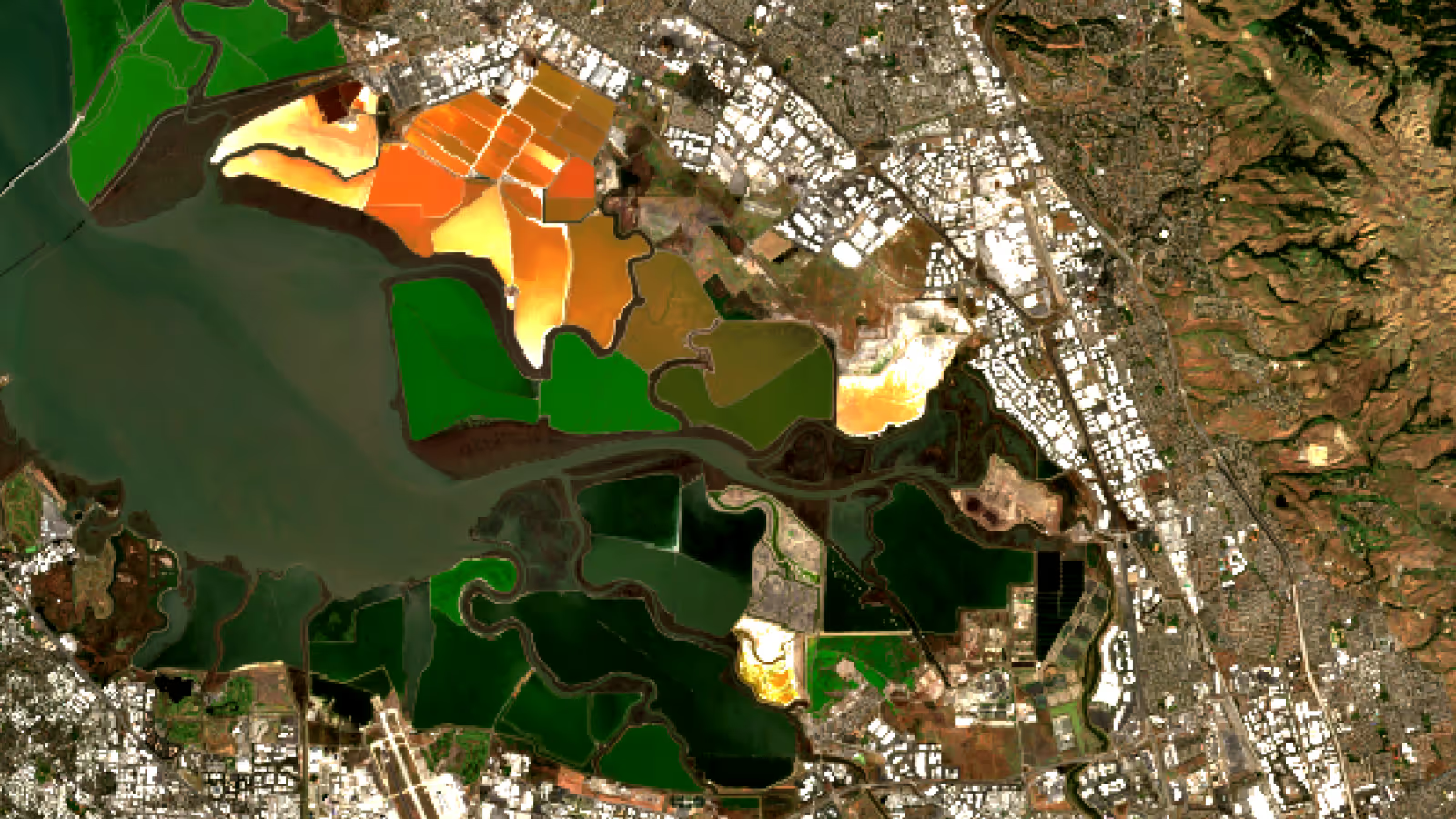
Image: The San Francisco Salt Ponds as seen by Sentinel 2.
The Copernicus Sentinel-2 mission is a European wide-coverage, high-resolution, multi-spectral imaging mission designed to monitor changes in land surface conditions. It is part of the European Union's Copernicus Programme for Earth observation and began operation in June 2015. The mission consists of two identical satellites working as a team to provide more frequent measurements. Clouds will affect it, so you will get better results when you apply a cloud masking block to this data.
Earth Blox verdict
The Sentinel-2 mission is a cornerstone of Europe's Copernicus Programme, providing high-resolution (10m), multi-spectral imagery with a high revisit frequency (5 days). It is freely available high-quality data that can support a wide range of environmental, societal, and economic applications. With its frequent coverage and 10m resolution, it's no wonder that it is the most used satellite data set in Earth Blox.
Pros:
✅ Higher spatial resolution (10-20m) than Landsat (30m).
✅ Higher revisit frequency (5 days with two satellites) than Landsat (16 days).
✅ A long-term commitment to the continuity of service so you can plan commercial services into the future, confident of the supply of data.
✅ More spectral bands (13) than typical commercial offerings (~4-8).
✅ High-quality calibration (better than commercial sensors), allowing for more sensitive measurements.
✅ Includes valuable “red-edge” bands that offer optimum vegetation health mapping.
✅ A free and open data policy. Makes it highly accessible for a wide range of users and applications.
✅ Can be used for a wide range of applications over land, ice and coastal regions.
Cons:
❌ It is an optical sensor, so coverage is limited by clouds.
❌ The spatial resolution is still relatively poor compared to commercial alternatives (which can typically be 1-4m).
❌ Lower temporal resolution than some commercial providers (Planet has a large constellation of satellites offering daily revisit).
❌ No thermal bands.
❌ It is raw imagery, not a data product, so you do need some technical knowledge to use the data effectively.
Technical specs
Ground sample distance (pixel size): four bands at 10m, six bands at 20m, and three bands at 60m (for aerosols and cloud detection).
Coverage: Global terrestrial surface.
Metrics: For terrestrial vegetation mapping, the NDVI metric is a standard data layer to derive from Sentinel-2 data. Other indices can also be derived for urban areas, snow and water. The red edge bands also allow detection of more subtle vegetation health indicators.
Frequency: 5-day revisit period.
Expert review
What is the mission?
Sentinel-2 is the second of the Copernicus series of Sentinel satellites (the Sentinel 1 radar mission being the first). The Copernicus Programme is the European Union's Earth Observation flagship program, designed to monitor the planet and its environment to enhance understanding and benefit European citizens. It is also designed to promote European companies that offer space data services by providing a free and open data policy and a long-term commitment to providing the data up to and beyond 2035.
Unusually, there are currently three Sentinel-2 satellites in orbit instead of the normal two. This is because while 2C has already been launched (the third in the series, launched in 2024), they have not yet retired Sentinel-2A (although they will eventually). During this time, therefore, there is even greater data coverage while the three satellites operate together.
What kind of data is it?
Sentinel-2 carries an electro-optical sensor that measures in the visible and near infrared. The 13 bands are optimised for studying the land surface, fresh water and the coastal zone, especially across various sectors such as agriculture, forestry, urban monitoring, climate change, and emergency management.
The four 10m bands in the visible and near infrared are designed for observing vegetation, water, and urban areas due to their interactions with chlorophyll, water absorption, and reflective properties of built-up surfaces. The three 20m “red edge” bands are located in the portion of the spectrum where vegetation reflectance rapidly increases from red to NIR. They are highly sensitive to chlorophyll content and vegetation stress, making them invaluable for topics such as precision agriculture and forest health monitoring. All the other bands are important for determining the impact of cloud cover and for atmospheric correction on the other bands.
How does the data perform?
While Sentinel-2 does not yet have the very long archive that we see with Landsat, it will soon reach the milestone of having collected a decade of data (in 2025). This is relevant as many key metrics for forest carbon projects necessitate setting a baseline over the previous 10 years.
The very high quality of the calibration has also led to its use by both public and private organisations worldwide for the calibration and validation of their own systems. Commercial satellite firms, including Planet, utilise Sentinel-2 data for cross-calibration and validation of their sensors.
As with all electro-optical sensors, clouds are a problem. By selecting the Cloud Score + option on the cloud masking block, Earth Blox users can mask pixels with greater than a threshold percentage of cloud cover. The Cloud Score+ is a machine learning algorithm used to find clouds and shadows in Sentinel-2 data. Initiated in 2023, Cloud Score+ provides a per-pixel “usability” score that can be used to mask or weight observations based on their overall quality.
What is the data good for?
The widespread use of Sentinel-2 data underscores its continued high value. It has produced major scientific and economic benefits in areas such as agricultural crop mapping, water use, disaster support, land-cover and land-use change mapping, ecosystem and habitat mapping, and climate change monitoring. Much as Landsat has done for decades, Sentinel 2 data is now another fundamental tool powering the modern digital economy with cross-sectoral applications.
A colour composite Sentinel 2 image from the Flevoland in The Netherlands, an area of intense agriculture.
What level of detail does it detect?
Whereas Landsat had a legacy archive that meant a 30m pixel was kept for consistency, Sentinel-2 (S2) was free to start from scratch and so set a 10m pixel as the new standard for land surface monitoring. Although the 30m Landsat pixel still has value, user expectations have now increased because of S2 and anything poorer than 10m now seems meagre. 10m is certainly good enough to collect measurements over small agricultural fields and most forest conservation or carbon project sites. It is not quite good enough to determine individual trees.
There are also three “red edge” bands, designed to capture the subtle variations in the reflectivity of vegetation as it crosses from red to infrared. To pick out the small changes in this signal, they have narrowed the range of wavelengths that each band is sensitive to, but this also means less energy arriving at each detector. To compensate, they have to measure over a larger area, and hence these bands are at 20m – what you gain in spectral acuity, you lose in spatial resolution.
The two 20m Short Wave InfraRed (SWIR) bands also offer information to help determine soil and vegetation moisture, areas of burnt vegetation and urban areas, as well as help differentiate pixels with snow rather than cloud. The remaining three bands are 60m and are mostly there for added value to improve the quality of the other measurements by detecting properties of the atmosphere that impact the other measurements.
Suggested alternatives
Landsat: The Landsat programme is the longest-running series of satellites dedicated to mapping the land surface. With visible, infrared and thermal bands, Landsat is optimised for mapping land cover and land cover change. It has a spatial resolution of 30m, and data is collected every 16 days. The harmonised data in Earth Blox allows comparison from the present back to 1982. Read the Landsat dataset review here.
Planet: Planet offers several image products, such as the Forest Carbon Diligence maps, at higher resolution (<5m) than Sentinel-2, and so this is good for visual interpretation or for detecting features and change that are perhaps more apparent than would be detected by Landsat. However, neither the quality of the spectral information nor the calibration is as good. This data can be purchased via Earth Blox for use in the platform. Contact us for more information.
Iain is a Professor of Applied Earth Observation at Edinburgh University, specialising in active remote sensing. He has over 27 years experience in academia and industry, 100+ publications, and advises UK government agencies on EO strategy.
.avif)