In our ‘Meet the experts behind Earth Blox’ series, we talk to the people building the no-code Earth observation software-as-a-service (SaaS) that helps teams get rapid insights from satellite data, freeing up their time to focus on the big picture. We learn about their wealth of experience in remote sensing, Earth observation, carbon science, technology, and startups, as well as what drives them to build a product that is making a positive impact on the planet and people.
In the first post we talk to Sam Fleming, co-founder and Head of Customer Success at Earth Blox.
How and when did you become interested in Earth observation?

I knew I wanted to do something to help fight climate change, but at 18, I didn't know what kind of jobs were out there. In my final year in high school, I couldn't decide if I wanted to do physics or geography at university because I really enjoyed both. I eventually settled on geography, but halfway through my undergraduate degree, I was introduced to remote sensing. I thought, hang on a minute, that's just physics with geography, and that seems interesting.
I was studying really old maps, but when I saw the new maps being created by satellite, I thought that was really cool. I realised that satellites would be crucial in the fight against climate change, so it felt like a really natural way to work on the things I am good at and interested in.
That was the catalyst for focusing on remote sensing in my final year, and I took a class by Professor Iain H Woodhouse (Knowledge and Outreach Lead at Earth Blox) and went on to study for a Master's in Remote Sensing.
Tell us about your qualifications and experience.
I completed my undergraduate degree at Edinburgh University and then moved to London to do my Masters in Remote Sensing at UCL (University College London). Some of the modules were taught at Imperial College and King's College, which meant I was fortunate to be taught by some of the best professors in the country.
After I graduated, I worked in carbon footprinting for a software-as-a-service (SaaS) company that built a web-based tool for companies to calculate their carbon emissions. Whilst it wasn’t an Earth observation role, I learned a lot about consultancy and how software products can be used to help companies change their practices to reduce their environmental impact. I surprised the team by writing some code that turned a tedious task that would take weeks of work into something that could be automated in 30 seconds. This really brought home to me how much time could be saved if we could automate and streamline many data management processes, and that’s a learning that has been important for me in how Earth Blox can help people.
However, I really wanted to move back into remote sensing. Iain and Genevieve Patenaude (Earth Blox CEO) had recently set up Carbomap and were hiring, so I applied and got the job. This meant I moved back to Edinburgh, which I was quite happy about. In the seven years I worked there I gained a lot of experience, and my role grew to where I was working more operationally across the business and managing projects.
What's your role at Earth Blox, and how did you get involved?
It was at Carbomap that the idea for Earth Blox came about. We had taken on some interns and realised just how much time we needed to invest in training them to both understand the science of remote sensing and to be able to code our solutions. We started to think there must be an easier way, and so we put our heads together and developed a prototype of Earth Blox, which we were able to validate quickly.
While Carbomap was a service provider and a tech-enabled consultancy, Earth Blox was taking shape as a product, so it was decided to develop it as its own entity. In 2020, we were awarded funding from Innovate UK and secured early-adopter customers who were happy to work with us as we built the product. And here we are today with Earth Blox being used by a range of customers from insurance to carbon offset project assessments and monitoring, to education institutions looking to make Earth science courses more accessible.
What project or experience are you particularly proud of?

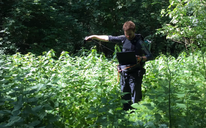
In my role at Carbomap, I did a lot of fieldwork. I've been to Austria and Canada for validation and calibration of our remote sensing work. As part of the Forests2020 project, I worked with teams in Mexico, Brazil, Colombia, Kenya, Indonesia and Ghana for forestry projects. In Ghana, we were tasked with mapping cocoa plantations using drones. There are two types of cocoa, one is sun-loving, and the other thrives in the shade. The sun-loving cocoa grows fast but requires forests to be felled. The shade-loving variety grows under forest canopy and, while initially slower, provides more crops from the tree over time. To guard against deforestation, there's a huge drive by the Ghanaian government to get farmers to plant shade-loving cocoa.
The Ghanaian Forestry Commission have a requirement to map cocoa across the whole country. Due to budget and time constraints, this wasn't possible with drones so we looked to combine the drone data with satellite data to scale up the analyses. Researchers at the University of Leicester worked on building a model that could map the entire country using our classification from the drone data that fed into the satellite models. However, even our drone data needed supplementing because it wasn't granular enough, and shade-loving cocoa is easily confused with natural forests. So I led my team in collecting field data on the land cover which fed into the classification model as training data. It was quite a challenge, but I really liked the intersection of the data science, as well as seeing first-hand the farmers who were growing the crops and understanding the impact on them and ensuring their livelihoods could continue while we work to stop deforestation.
At the same time, the Ghanaian Forestry Commission wanted to be able to do this mapping themselves. While they had the cocoa domain expertise, they did not have enough Earth observation capacity within their team. It provided a spark for me as I could see first-hand how Earth Blox could help solve this problem in the future.
The combination of field data with remote sensing is really powerful, and so my fieldwork experience gives me a really good understanding of what Earth Blox can do for our customers and how it can develop to meet their needs.
What does your work at Earth Blox involve? What does a typical day look like?
Communication with our customers is at the heart of my role as Head of Customer Success. That means listening carefully so that I understand what they are trying to achieve so I can show them how to use Earth Blox. A typical day involves meeting with two or three customers, updating our Knowledge Hub with 'how to' guides and answering any support questions that come in overnight. I also capture feature requests to pass on to our product team to explore, and I am always testing new features and functionality.
I also get involved with technical demonstrations for potential new customers, showing them how to use the software to run their analyses and get answers to their questions from the data. And when our business and enterprise clients sign up, I work with them to get them up and running with the software and provide training for their team.
Why is building Earth Blox important to you?
There is a huge amount of value in satellite data that is being missed or is not used to its full potential. At the same time, I've worked with some amazing domain experts who know so much about their field but aren't able to make the most of this data. The potential for domain experts to be able to easily access and work with satellite data means we can work faster in the fight against climate change.
How do you think Earth observation technology will evolve in the next 5-10 years?
One of the great things about Earth Blox being headquartered in Edinburgh is that Scotland is a world leader in the space industry. We've got a nice balance between Edinburgh, where it's all about downstream applications and making use of space data, while Glasgow is focused upstream. The city builds seven times more satellites per year than any other city in Europe. Glasgow is renowned for building really small satellites called CubeSats, and some companies have plans to launch hundreds of mini-satellite constellations. That's going to be a real game changer in terms of the kind of the temporal coverage, such as how often data is collected. It also means you can get niche data products to tackle very specific challenges. It's difficult to predict the impact that will have, and because it will be commercial, it creates barriers for a lot of people, but the cost will eventually come down, and it will open up a range of new use cases, such as improving ways to estimate the kind of carbon in vegetation or measuring methane emissions. Currently, satellites are used to measure, and each pixel is multiple square kilometres in size, but with smaller satellites, you might be able to map this on a more granular basis. Use cases will shift from macro, at a country and government level, to micro, where more and more organisations use satellite data in their operations and in the drive for net-zero emissions.


