After studying Biomedical Science and working in healthcare laboratories for several years, I realised that diagnostic laboratory work was not my passion. Driven by a strong interest in plants, and concern surrounding the climate crisis and its effect on global biodiversity, I enrolled on the MSc in Biodiversity and Taxonomy of Plants at the Royal Botanic Garden Edinburgh with the aim to combine my laboratory and research skills to contribute towards understanding threats to biodiversity, and species conservation.
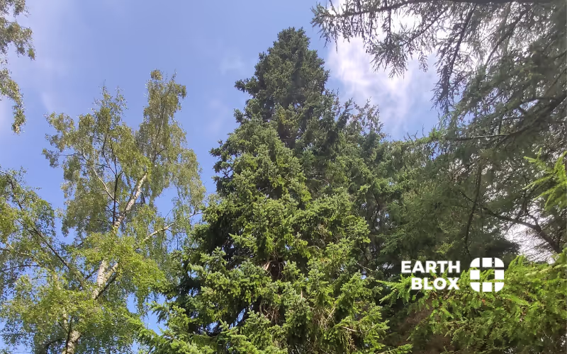
I became interested in conifers during a field trip to Chilean Patagonia, part of which involved an investigation into the mycorrhizal fungi associated with the Patagonian cypress (Fitzroya cupressoides). Although conifers seem abundant, particularly in the boreal forests that cover swathes of the Northern Hemisphere, approximately 34% of conifer species, including the Patagonian cypress, are threatened with extinction globally due to previous overexploitation, and now, climate change.
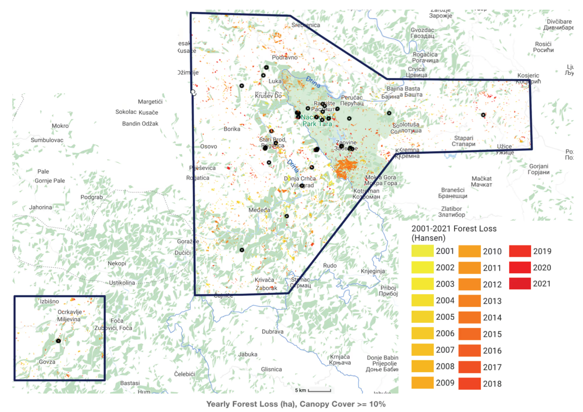
Upon my return, I decided to carry out my MSc thesis project in collaboration with the International Conifer Conservation Society (ICCP) to investigate the threats to other conifer species, such as the Serbian spruce (Picea omorika). Once widely distributed in boreal regions across Asia and Europe, populations of this IUCN red-listed conifer are now limited to ~26 fragmented stands across a narrow range of ~100 km2 in the Central Balkans. Although the area of occupancy for this species has been drastically affected by uncontrolled wildfires, floods, and periods of drought over the last twenty years, little was known about the degree to which this species has been affected by these factors, or whether the current range was likely to retain suitable climatic space over the coming decades. There was also a need to understand whether the current ex-situ cultivation areas for Serbian spruce within Europe, which have been largely driven by the ICCP, will remain suitable in the future and, if not, to pinpoint areas for potential future ex situ conservation programmes.
Combining satellite, species, and climate data to quantify threats
I continued to work with the ICCP, using their knowledge and expertise to design a research project which aimed to harness a combination of novel satellite remote sensing data, species occurrence records, and present and future climate data to map and quantify the threats to Picea omorika both in situ and in ex situ populations across Europe. I initially planned to carry out most of the analysis in R, using Maximum Entropy Modelling for future climate projections and visualising results using QGIS. However, with my limited coding background, I found learning how to write and adapt code for my purposes a time-consuming process. I didn’t have the skills to understand where my code wasn’t working or the time to commit to learning this within the three months that were allocated to this project.
Finding a no-code solution for satellite data analyses
After several weeks of struggling with R, I was introduced to Earth Blox through my supervisor as an alternative. Earth Blox allowed me to work with data, run analyses, and visualise results in a way that was easy for me to understand with a limited coding background. I was able to access Google Earth Engine datasets to calculate annual forest loss and fire damage for Picea omorika over the last twenty years using the inbuilt workflows, which were easy to edit. The ability to import occurrence data, run analyses and visualise results on the map, then export these as graphs and charts saved a lot of time and provided a series of excellent figures for my thesis. Overall, I found Earth Blox much more intuitive to use compared to writing code in R. I used Earth Blox to build and run satellite image analyses in minutes, to produce output that I could easily export to combine with additional analyses, using MaxEnt and QGIS to understand current suitable climate space for Serbian spruce and how this is likely to change in the future.
Informing conservation plans
The results of this study showed that climate space for Picea omorika is projected to disappear almost completely within the native range. However, suitable climate space is projected to remain across large areas of northern Europe, which could provide potential sites for ex situ conservation. The outcomes of this study underline the need for policy changes within Serbia and Bosnia & Herzegovina regarding this species. I hope that an understanding of the current and potential future effects of climate change on Picea omorika will facilitate future conservation action and implementation of long-term management plans for the preservation and restoration of populations of Serbian spruce in situ. There is also a need for future research into which extant ex situ conservation projects already in place for this species are likely to retain suitable climate space over the coming decades. I hope that identifying the suitable current and future climatic space for this species, both within Serbia and Bosnia & Herzegovina, and across Europe will allow for better management of current ex situ populations by ensuring resources are appropriately invested for the preservation of this species.
Alice Peace
Alice Peace is an early-career conservation and biodiversity scientist. Having recently graduated with an MSc in Biodiversity & Taxonomy of Plants from the Royal Botanic Gardens Edinburgh, she is looking forward to the next step in her career, whatever that might be.


